LOOK OUT
A lookout, a fire tower, and a fire lookout are all terms to describe the same structures, but a lookout is more than a structure. It is an individual. It is a location, a high point on the landscape from which you can observe your surroundings.
With a decline in towers across the country and a rise in their popularity as rentals and hiking destination, this project reimagines fire lookout towers in the state of Oregon.
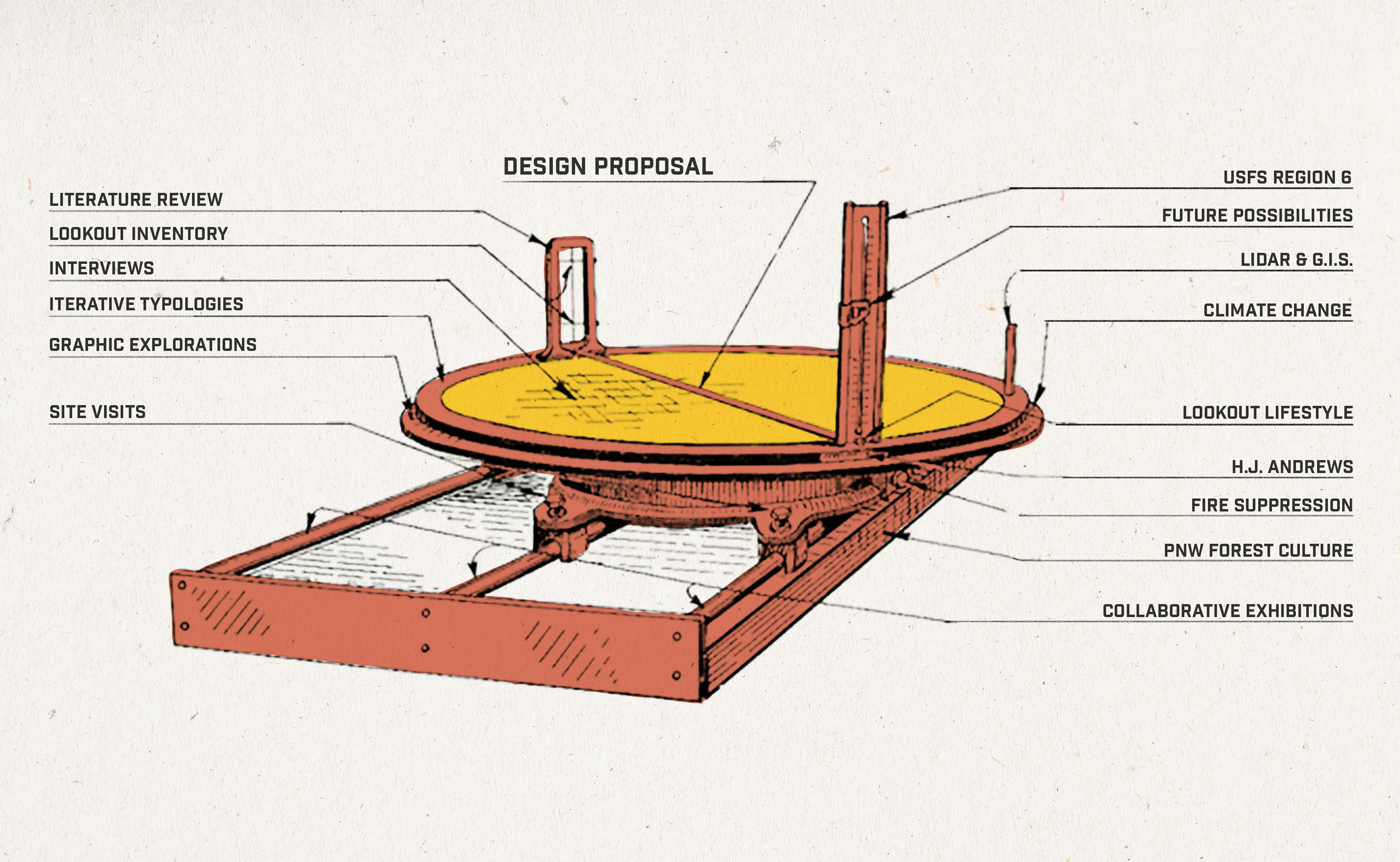
METHODS
My methods included developing an inventory of the standing lookouts of Oregon, generating typologies of those structures, conducting interviews, visiting lookouts, researching the history of lookouts and fire management using literature, and exploring alternative graphic styles.
TOWER INVENTORY
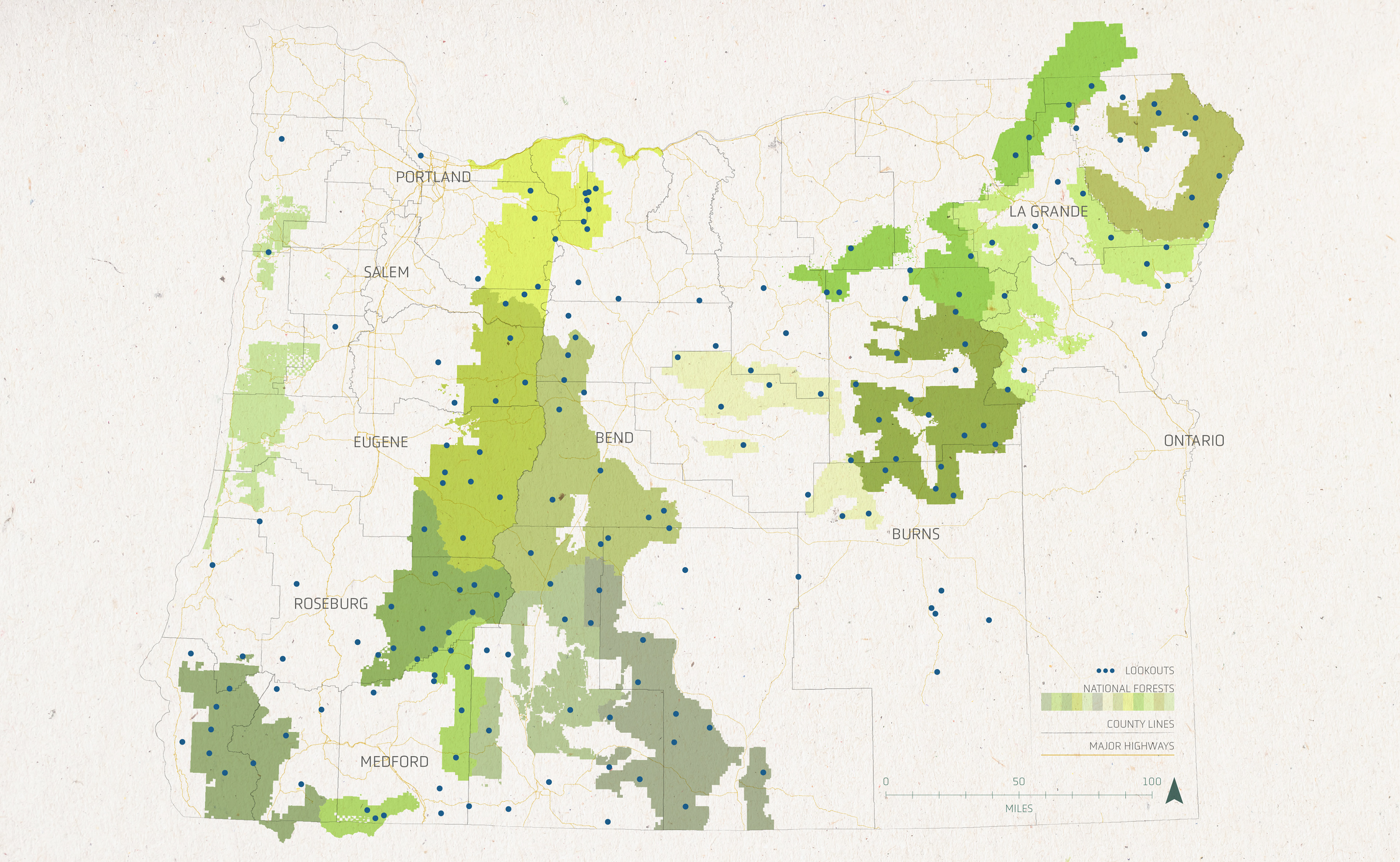
There were once 573 lookouts across the state. Today, around 150 lookout structures remain standing. Roughly 41% of those are staffed each fire season. 32% are abandoned, 13% are rentals, 11% are on reserve for emergency use, and 3% have been outfitted with fire detection cameras.
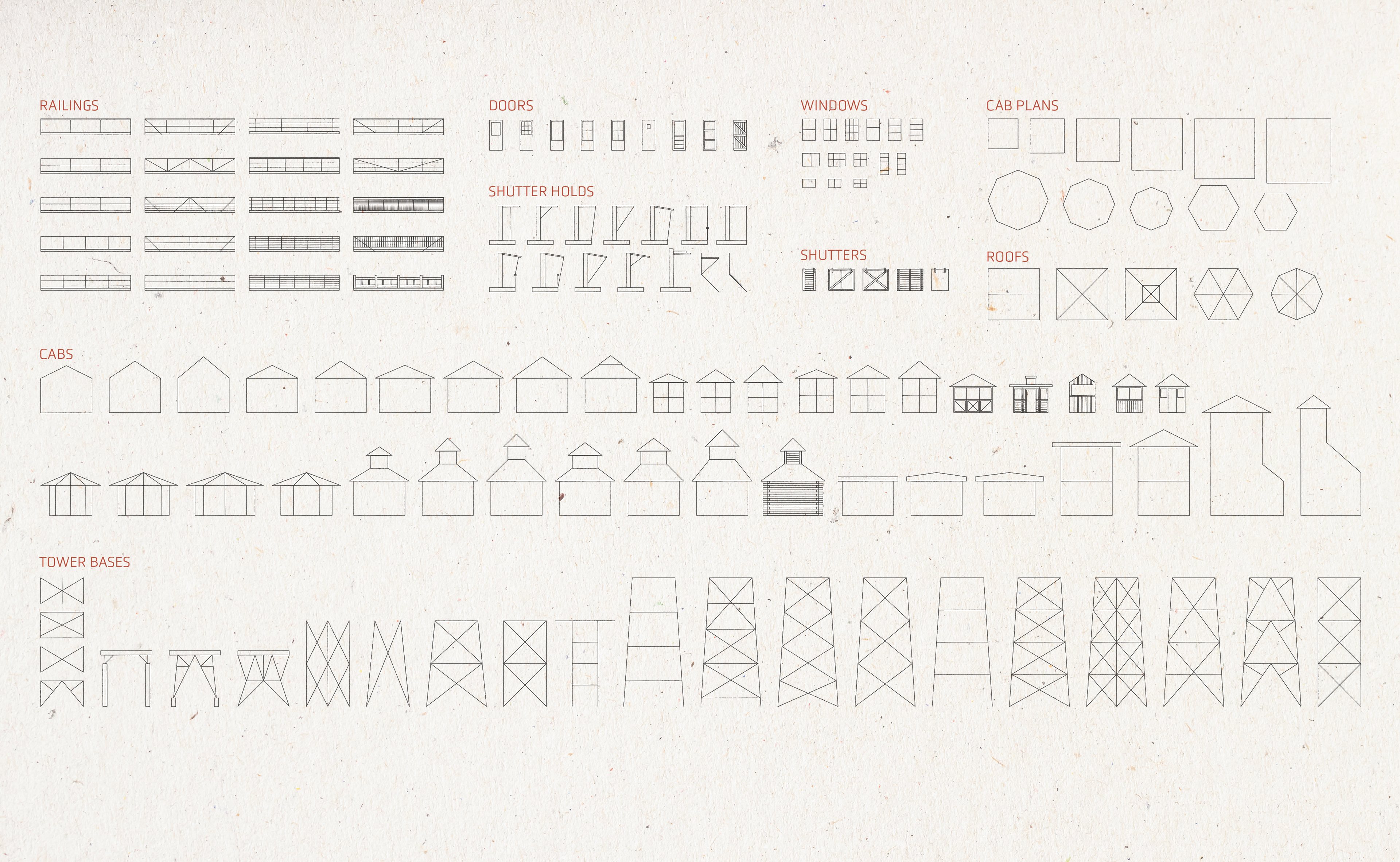
To best design Look Out, I began by researching the lookouts of Oregon. I created an inventory of all the past and present towers, from which I created a list of typologies to reference for the design stage. I referenced shutters, doors, shutter holds, railings, doors, windows, cabin size (cab plan), and roof style. Within the USFS Region 6, which includes Oregon and Washington, there are two significant designs: the R-6, a 15'x15' "flat cab" from the 1950s, and the D-6 cupola, a 12'x12' cab, popular from 1916-1929. The D-6 and R-6 are the most regionally significant and most influential in my design iterations.
Above: A map of the standing lookouts in Oregon, created using GIS and Adobe Illustrator; Below: Photos of the lookouts within the inventory

LOOKOUT HISTORY
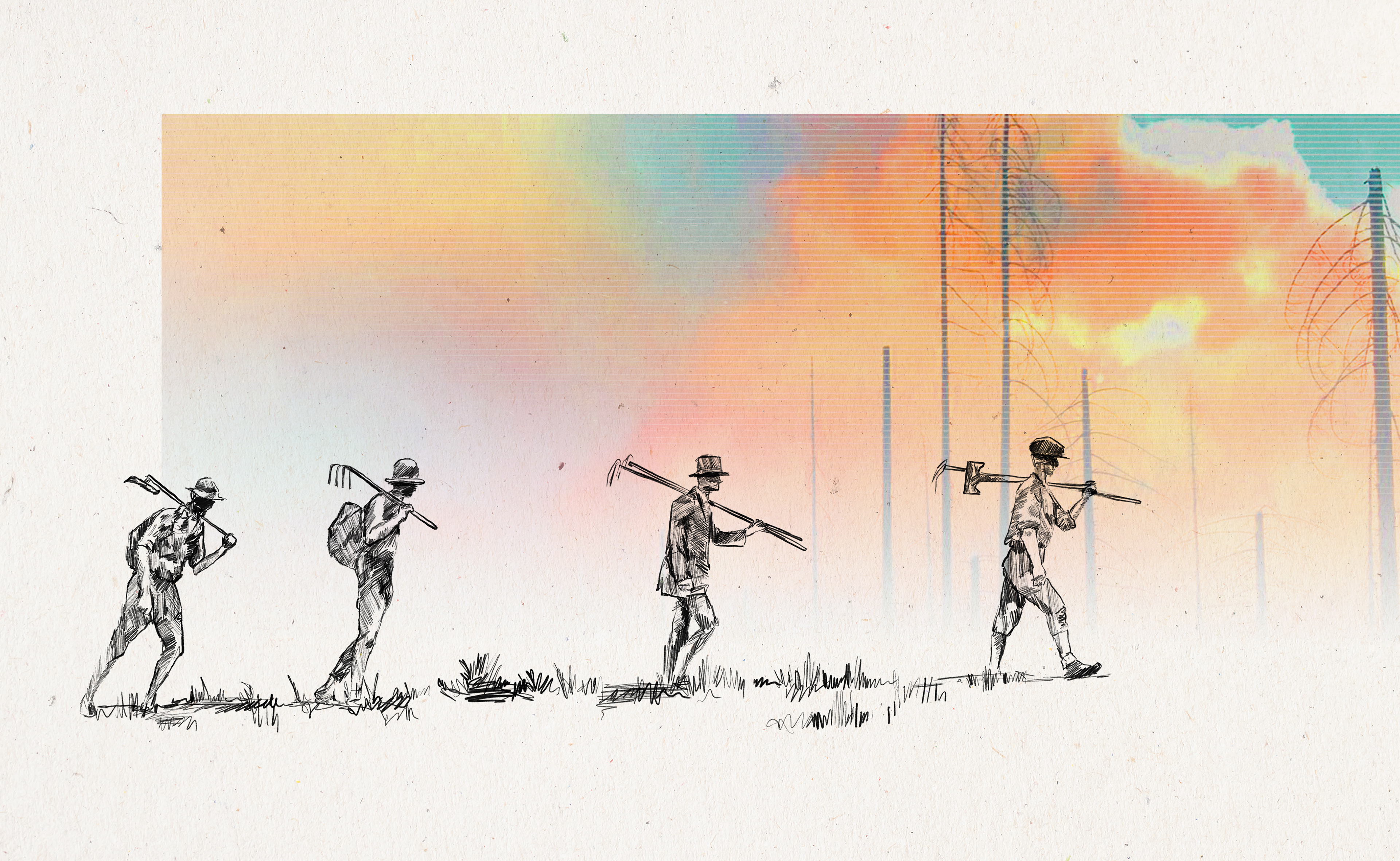
Early lookouts began as tent camps near peaks. To gain a better vantage point, crows nests were built in tall trees, some of which are still visible today. In the early 1900s, the first enclosed lookouts were constructed. The cupola style was one of the most popular - with living quarters on the ground floor and a cupola above to house the fire finder. In the decades following the Big Burn, the Forest Service built networks of roads, lookout towers, ranger stations and communication systems. By the late 1930s, over 5000 towers were built across the country, over 500 by the CCC.
Aermotor was one of the companies that streamlined tower production, offering a range of tower heights and prefabricated components for easy construction. The USFS also developed their own standards, such as the L-4 lookout. After WWII, Lookout towers were used, but to a lesser extent due to advancements in technology and use of surveillance aircraft and satellites. By the 1960s, a few hundred towers were in use across the country. Environmental movements and new ecological understandings altered the perception of fire on the landscape, recognizing it as a natural, necessary process by the mid-century. It is around this time that we begin to see a shift in agency policy: from fire suppression to fire management.
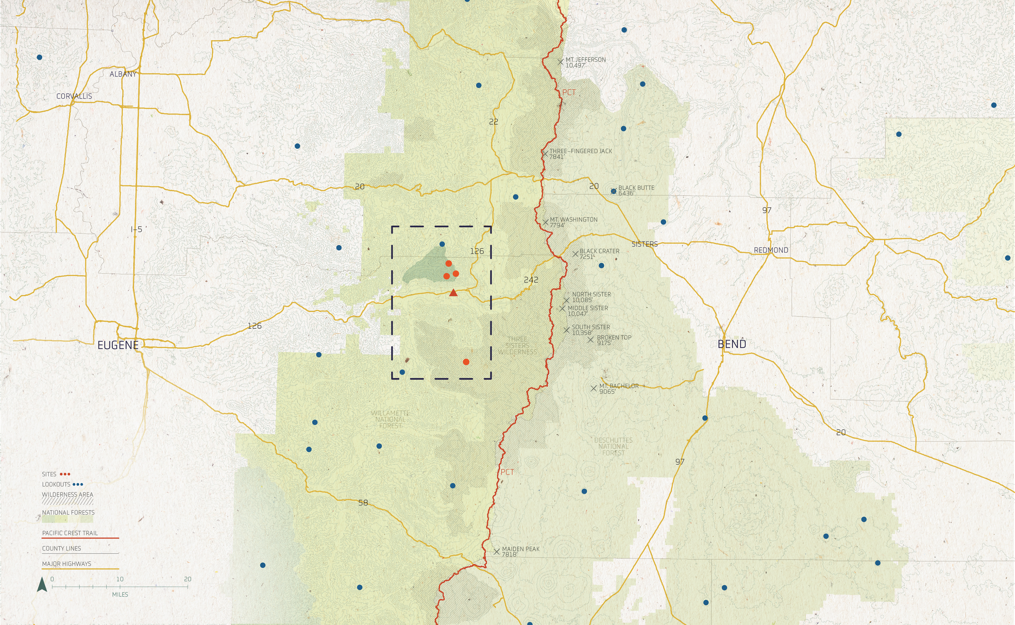
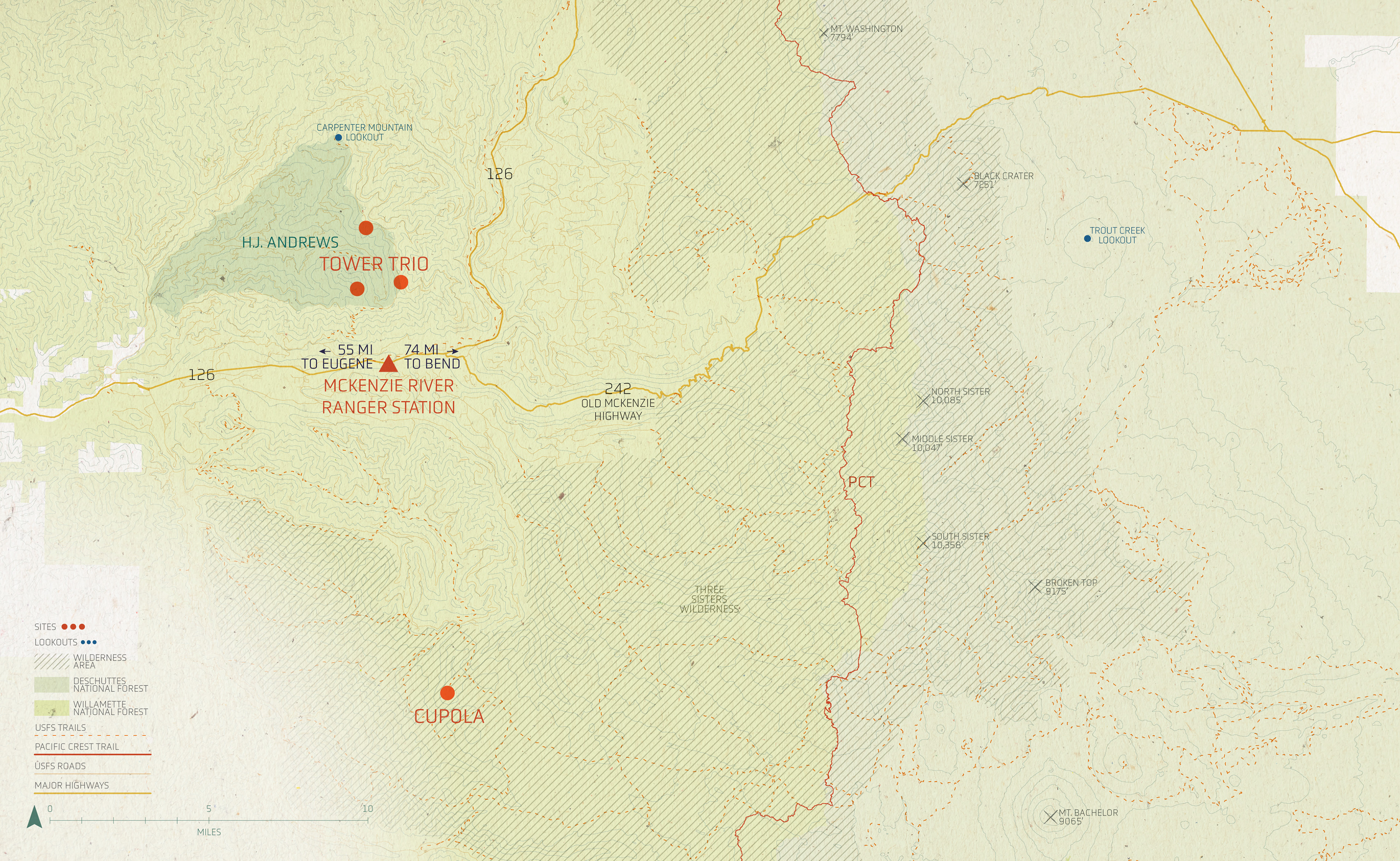
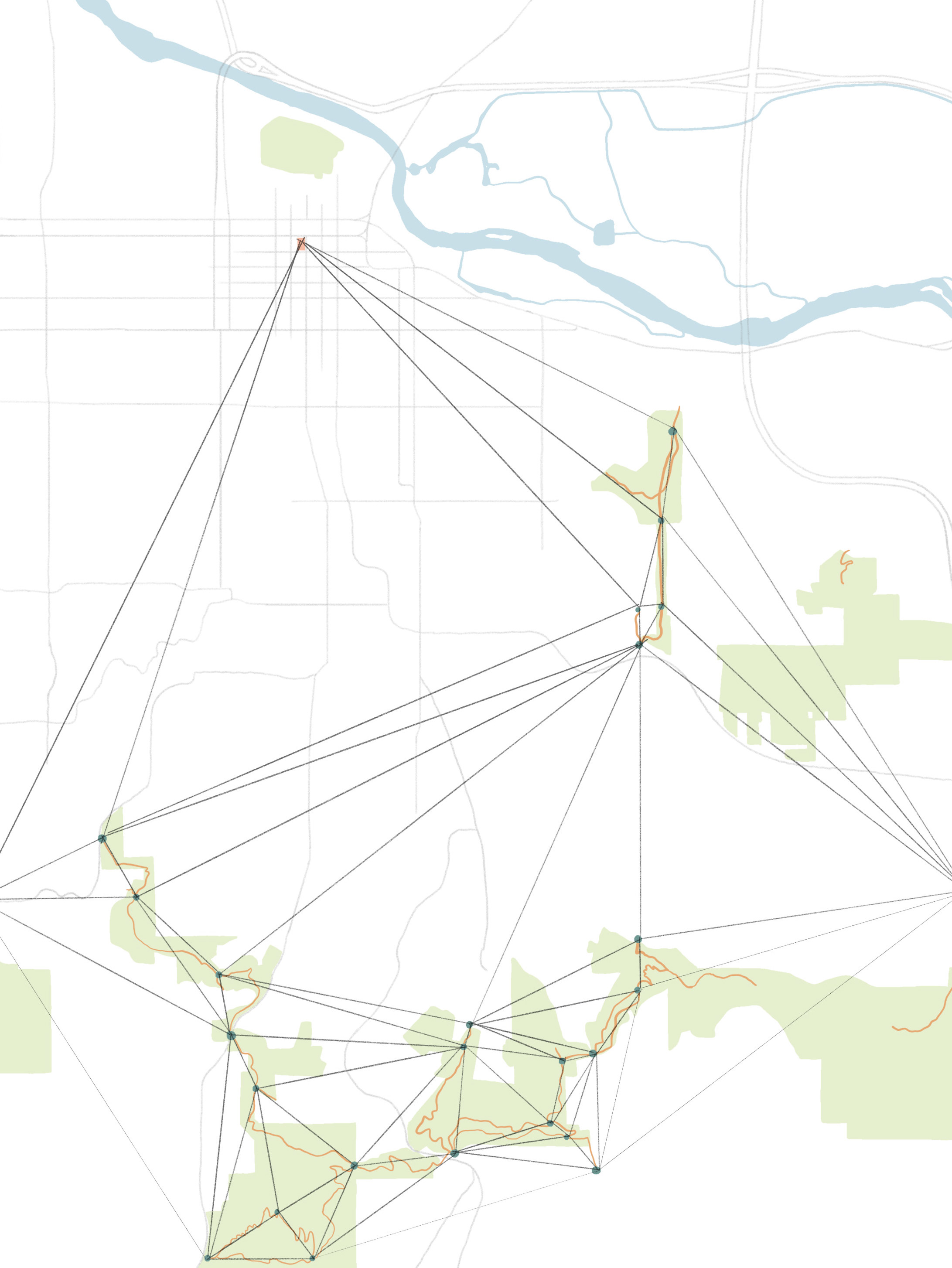
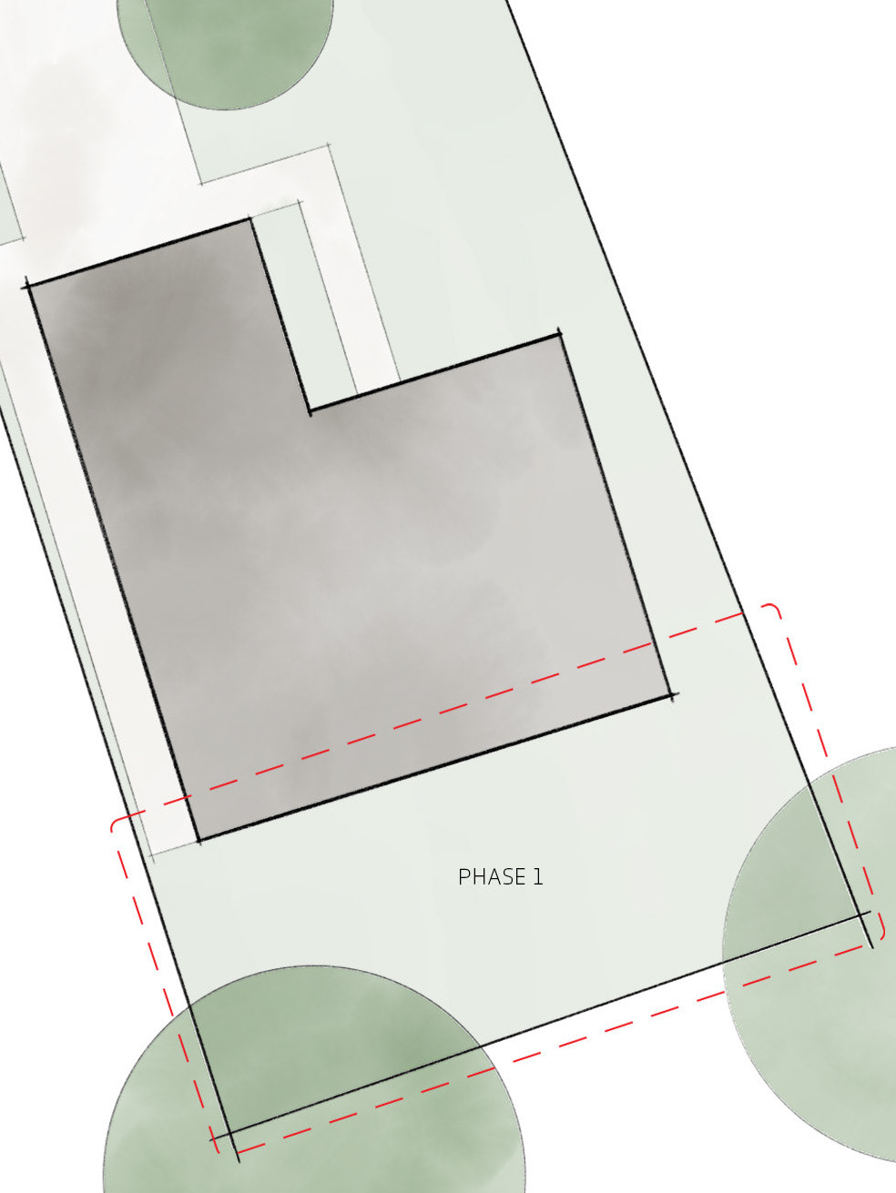
THE SITE
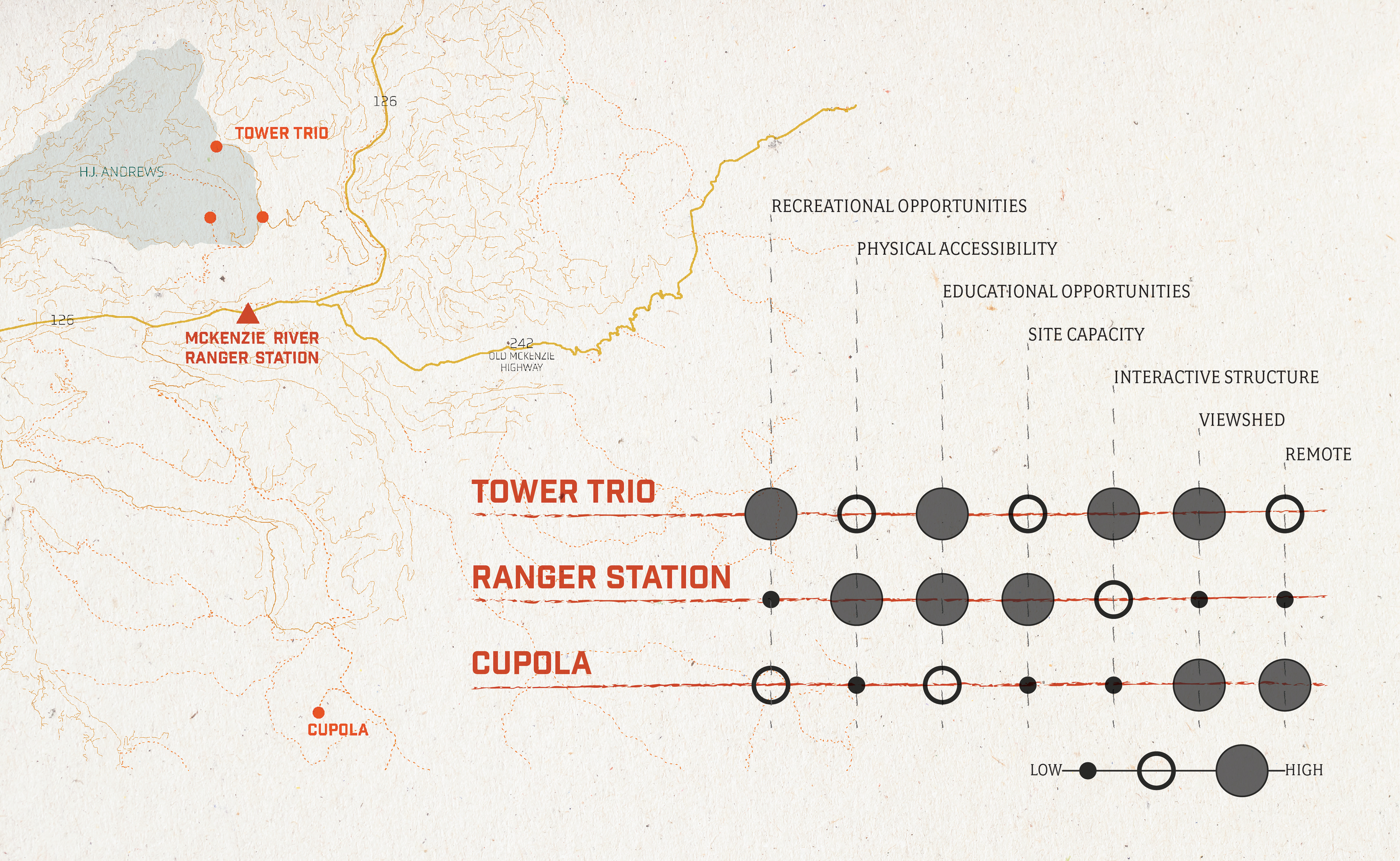
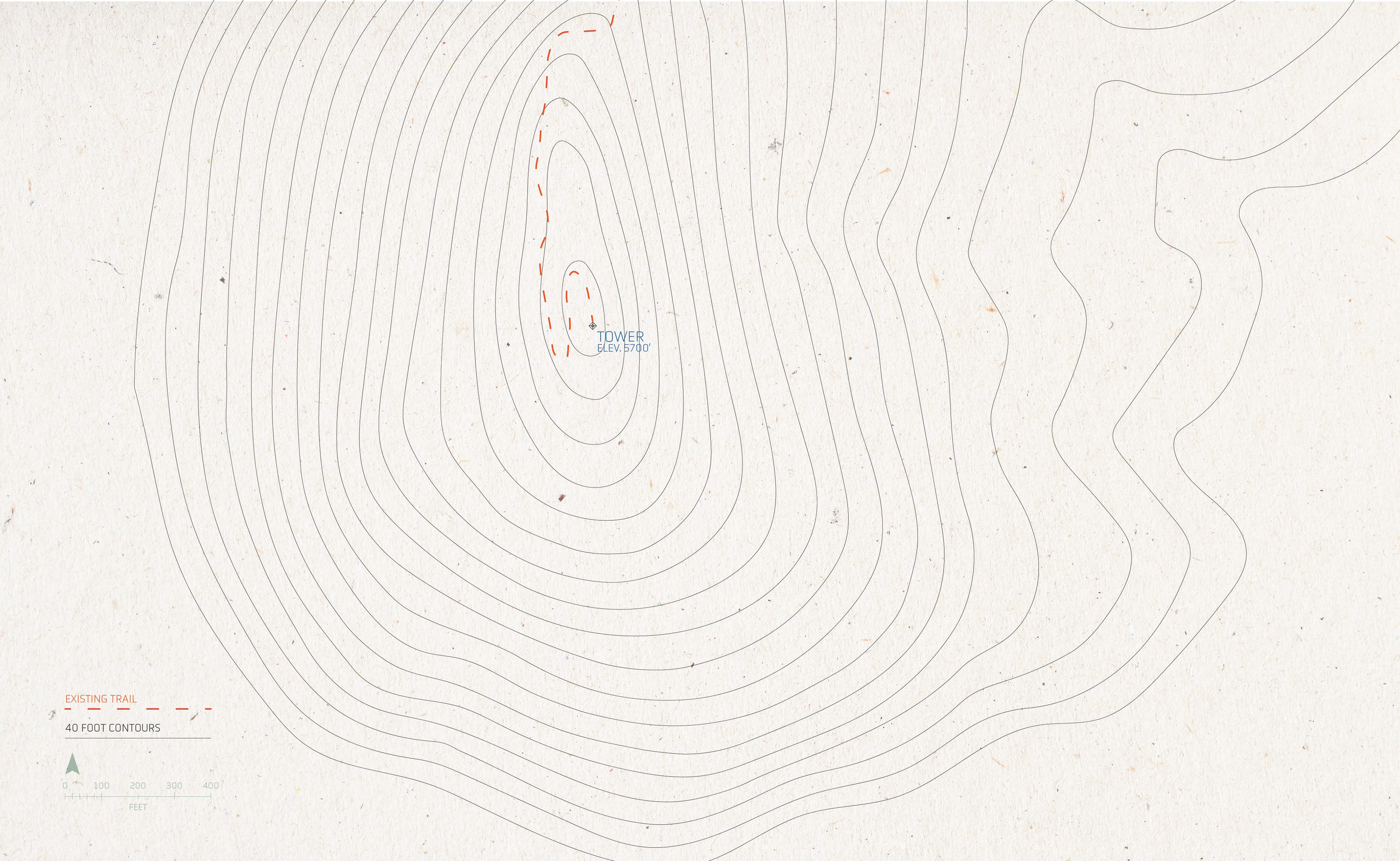
The site was chosen based on its central location within the state, proximity to major highways, including the Old McKenzie highway. The specific sites were chosen based on existing or historic infrastructure. There are 5 total key sites. The existing McKenzie River Ranger Station anchors the tower trio to the North and the cupola to the South. They all sit within the Willamette National Forest and, with exception to the ranger station, have exceptional views of the central Cascade peaks.
THE EXPERIENCE
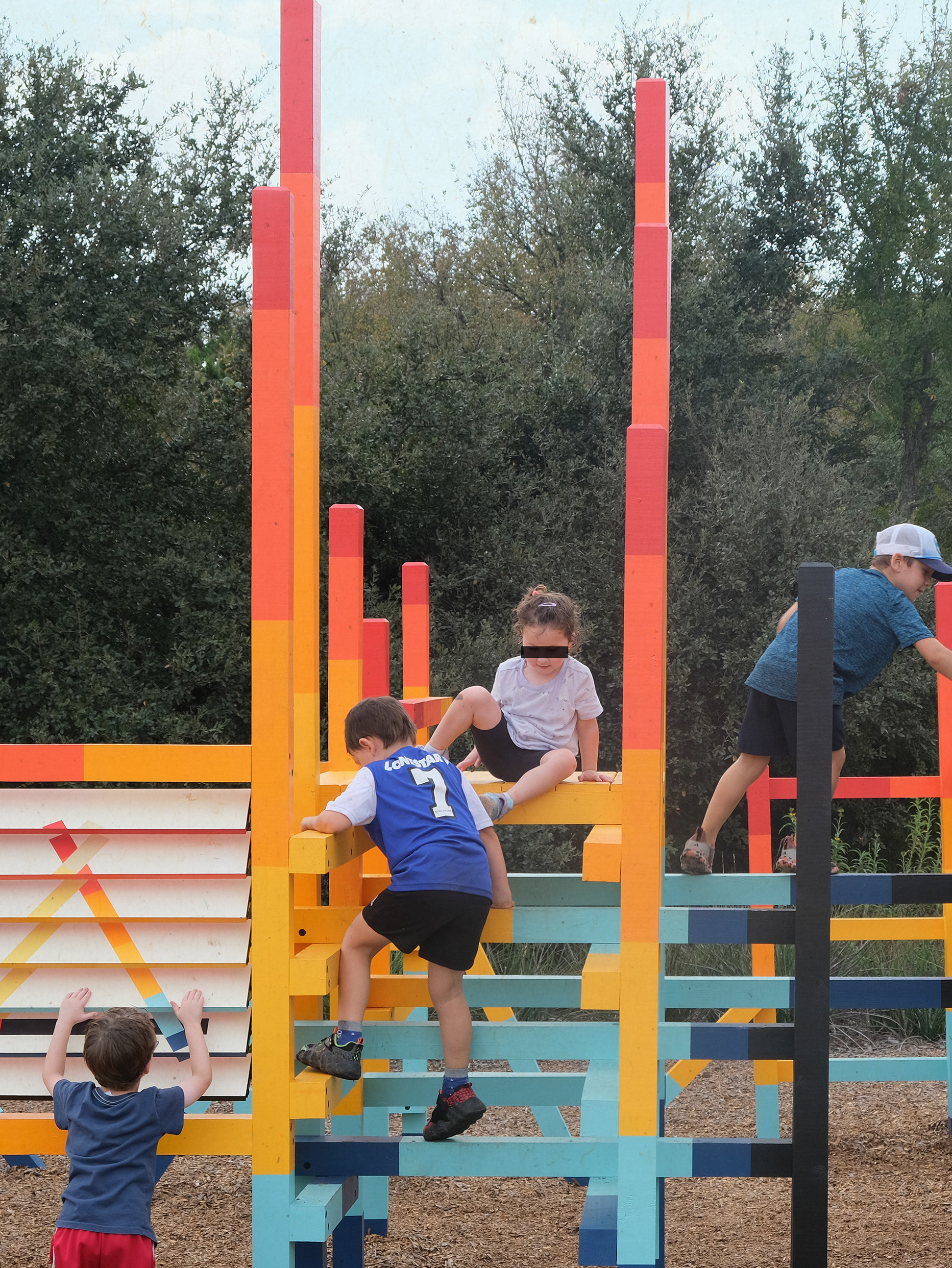
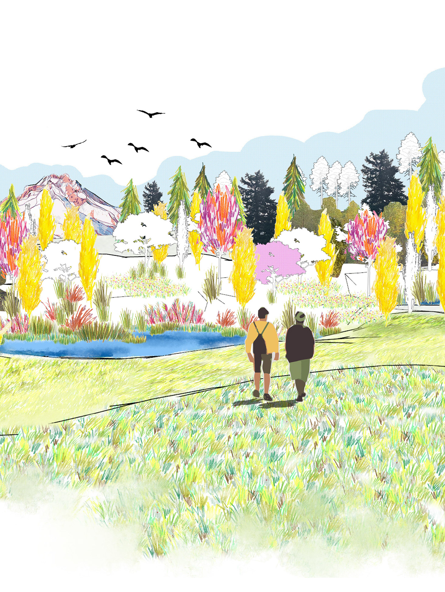
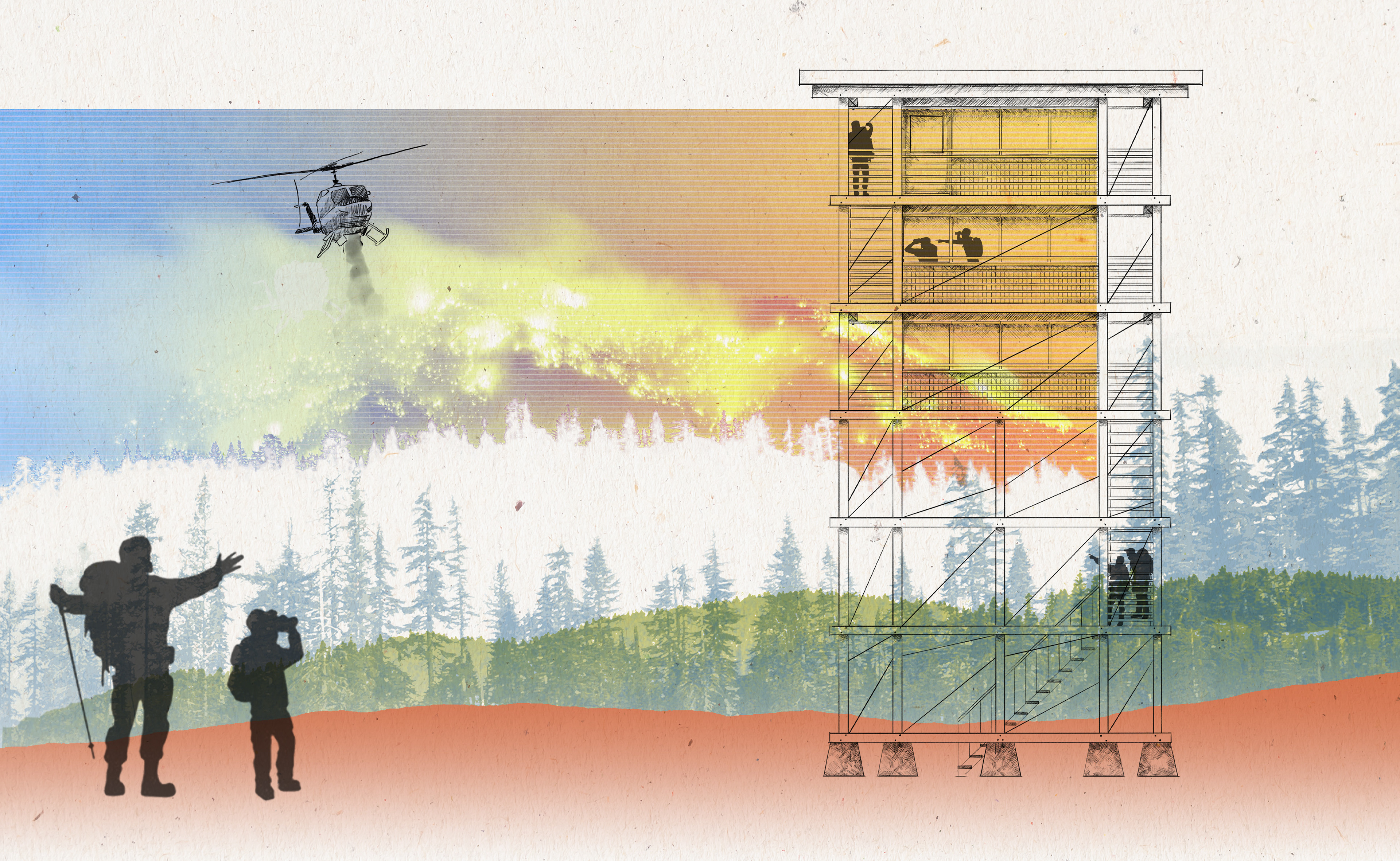
One of the most intriguing aspects of lookout life is living on the peaks: the view, the solitude, the responsibility. This project uses lookout towers as a means to generate curiosity and communicate concepts relating to climate change, land management, and our landscape's relationship to fire. Through engaging exhibitions, installations, programmed hikes, and interactive tower components, this project offers a variety of experiences in which to engage with the landscape and its history.
The ranger station acts as an accessible information center and permitting office - a first stop. Sitting along highway 126, 55 miles from Eugene and 74 miles from Bend, this ranger station has opportunity for high traffic community engagement. Currently, the visitor's center has a few small exhibits on display, but has space for additional interior and exterior interactive exhibits and installations, complete with stories from the region and historical artifacts. Permanent exhibitions would include fire fighting equipment, essential lookout and communication technology, the historic role of women in lookouts, and, of course, the story of Smokey Bear.
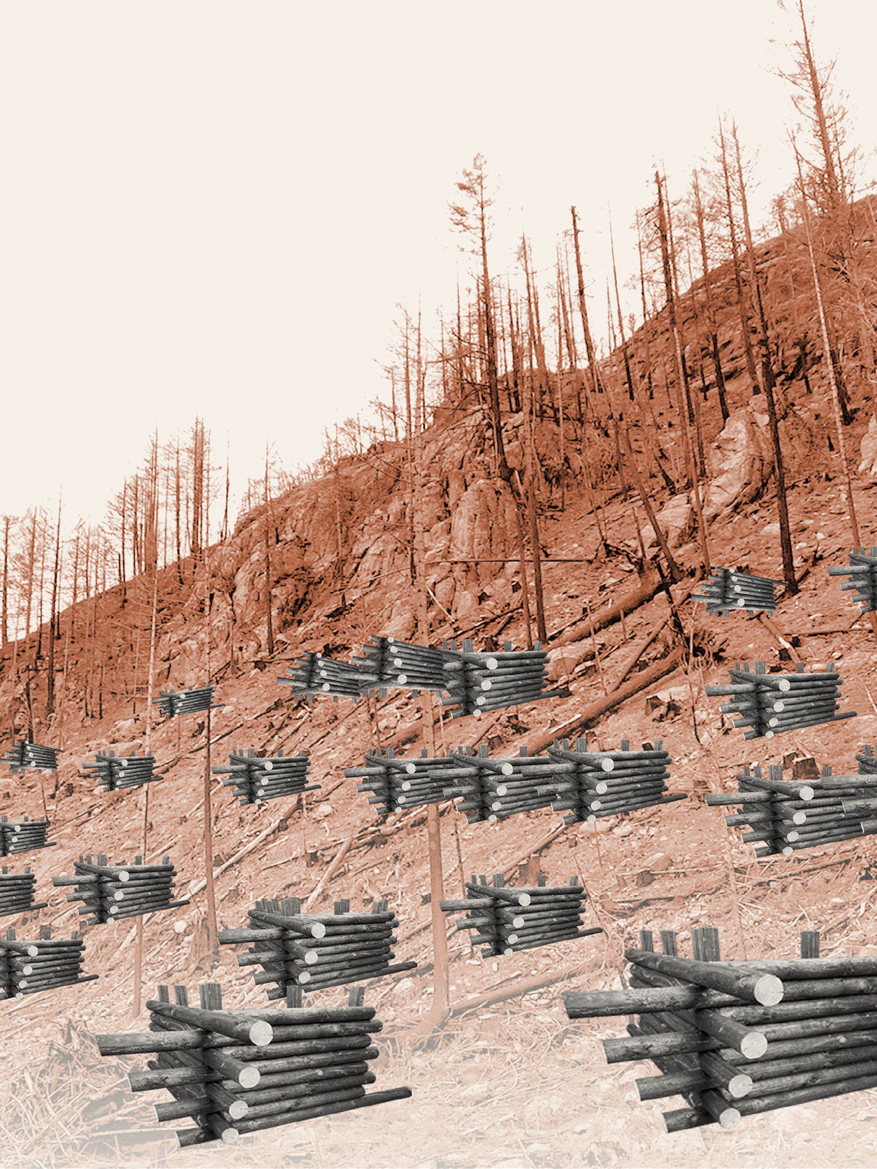
HIKES
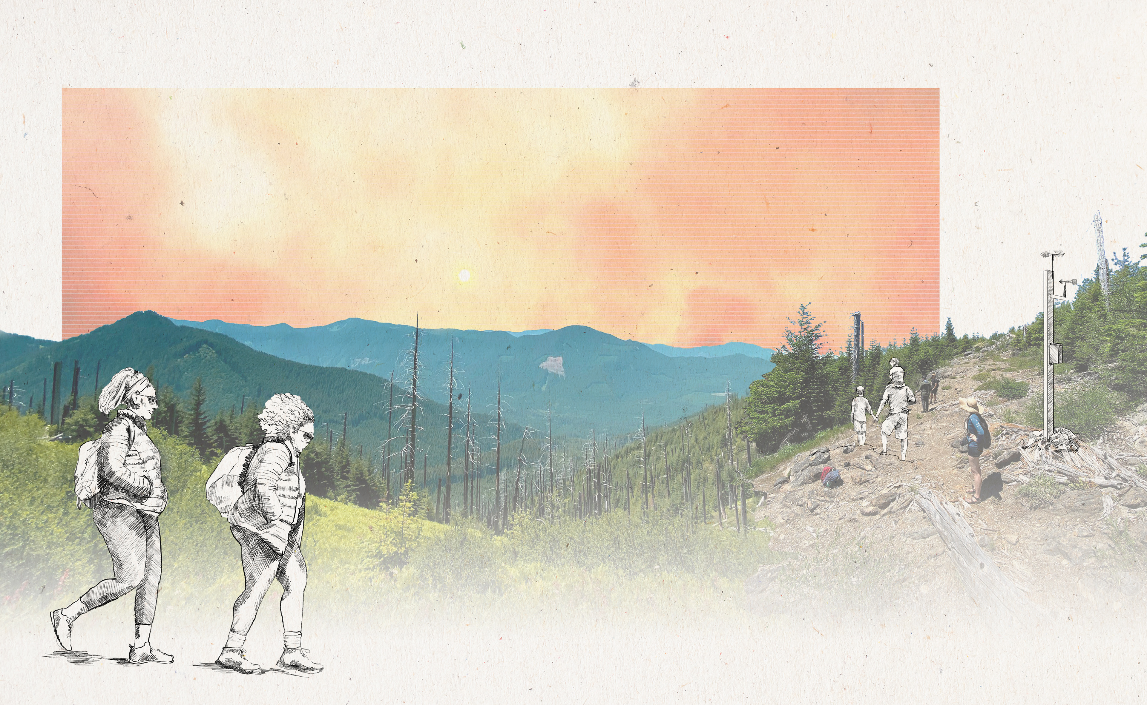
Hikes are often characterized by their destination: the view. However, the trails connecting the ranger station and other sites will offer an experience of their own, expanding on the narrative of fire and the landscape, past and present. These include varying fire severity landscapes, which could include programmatic prescribed burning or utilized existing burned forests, installations of historic lookout elements, such as crows nests, and interactive weather monitoring stations near the top.
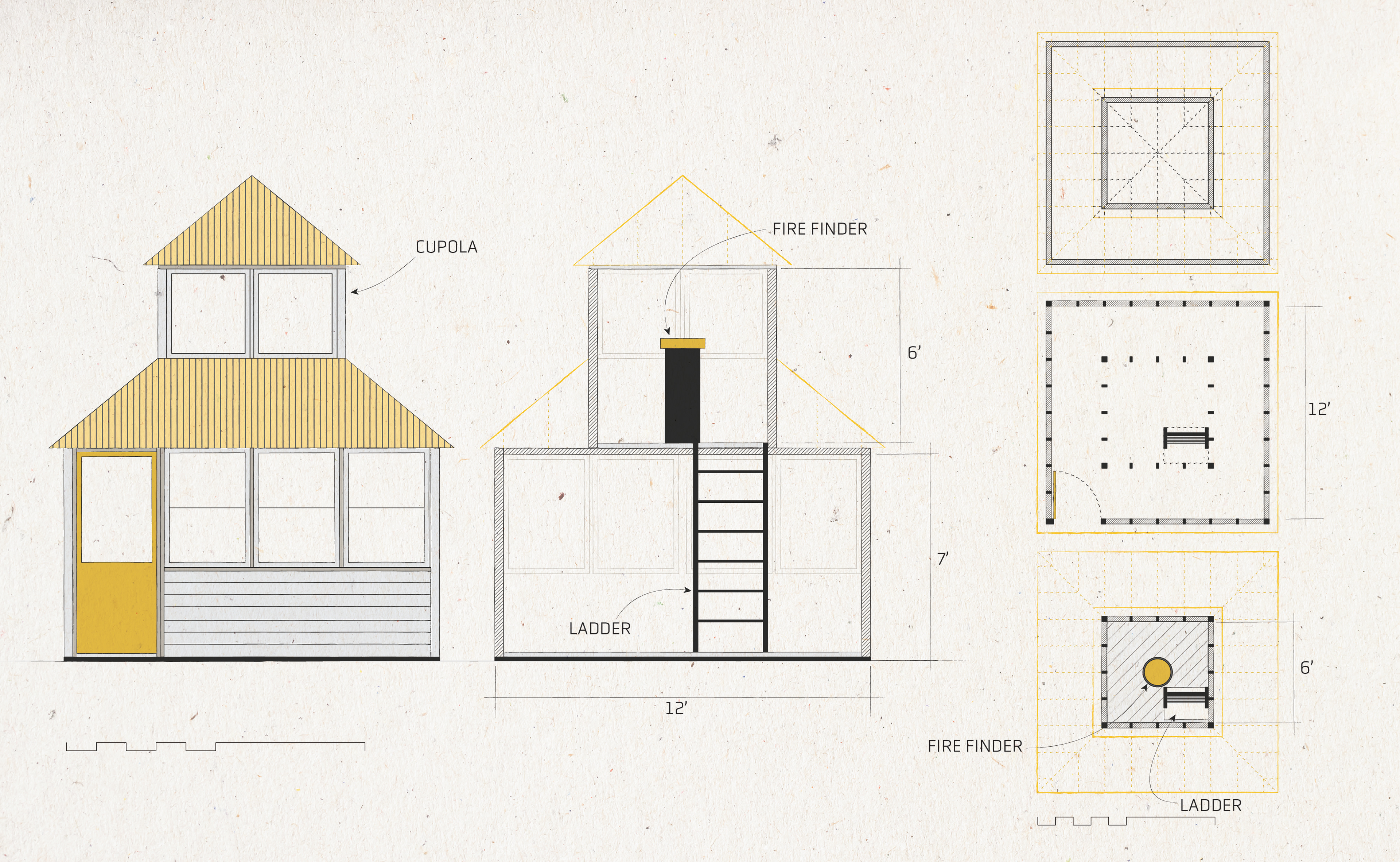
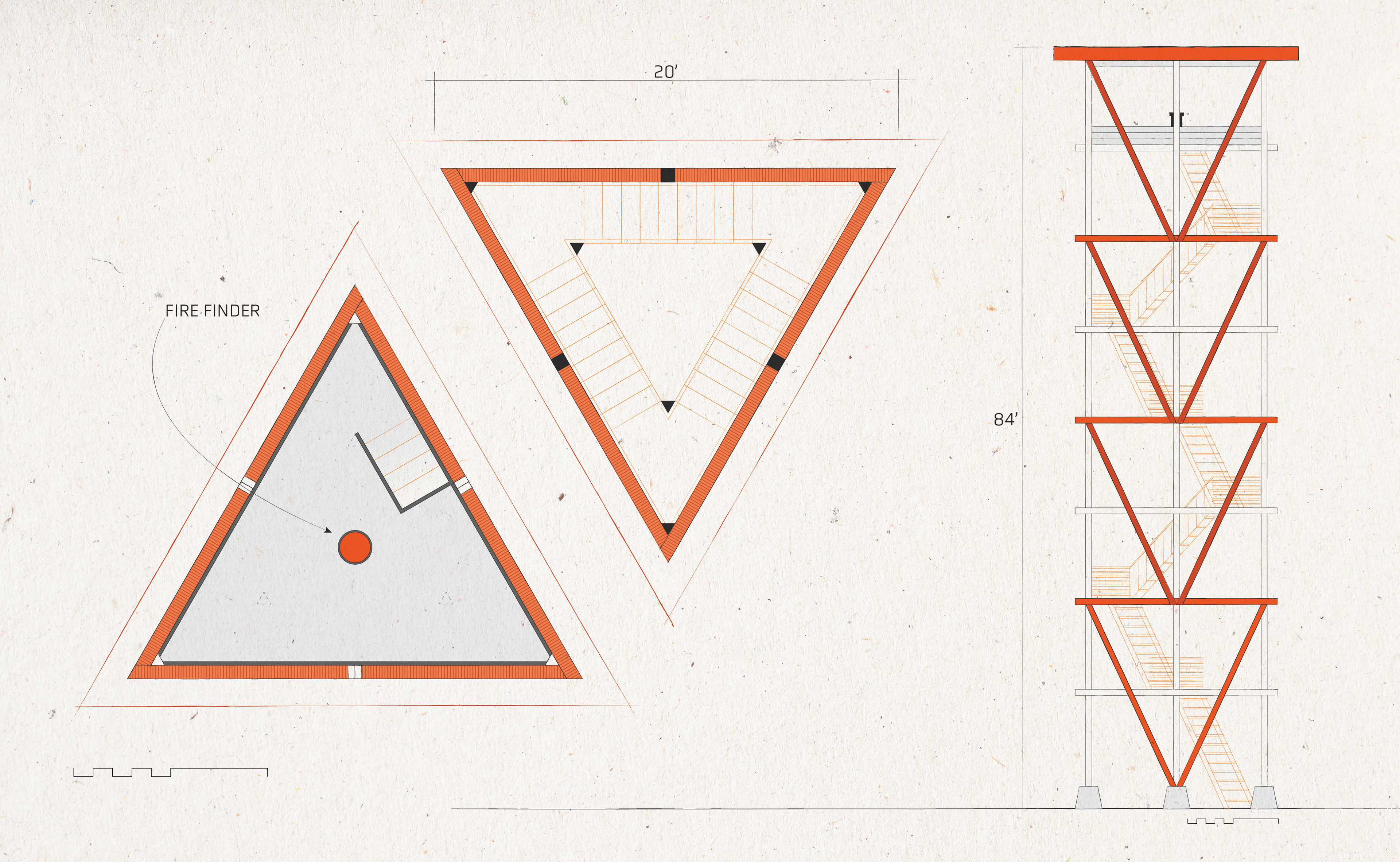
THE CUPOLA
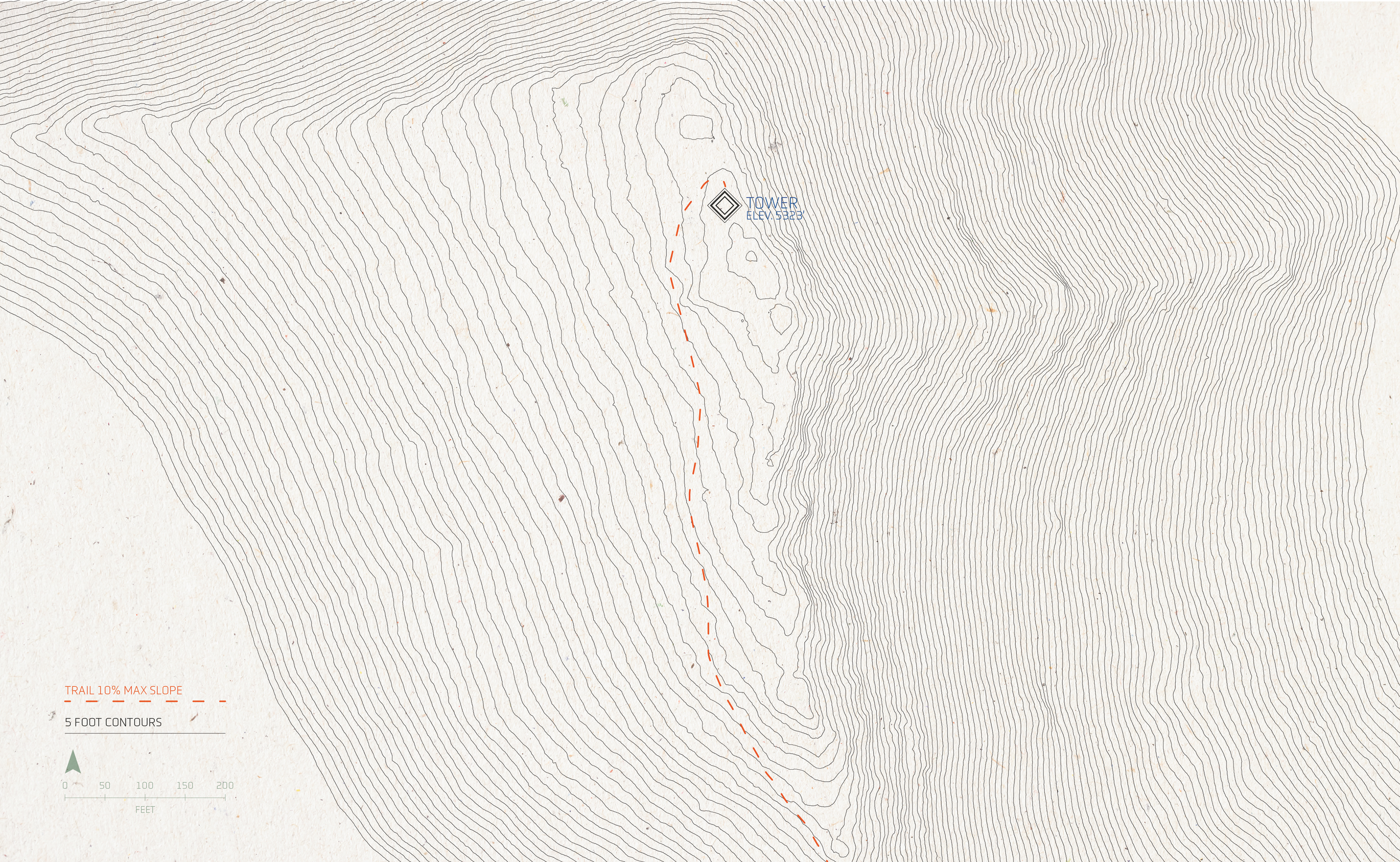
The first of the lookout experiences sits south of the ranger station in the Three Sisters Wilderness. Atop Ollalie Mountain, which housed the Ollalie lookout until a fire in 2019, this site is accessed using existing USFS roads and trails. This tower provides the ultimate lookout experience: opportunity for poets, artists, photographers, or any individual that wants to spend time in solitude, reflecting on their natural surroundings. This site would be reservable for individuals or couples, structured around an artist-in-residence program.
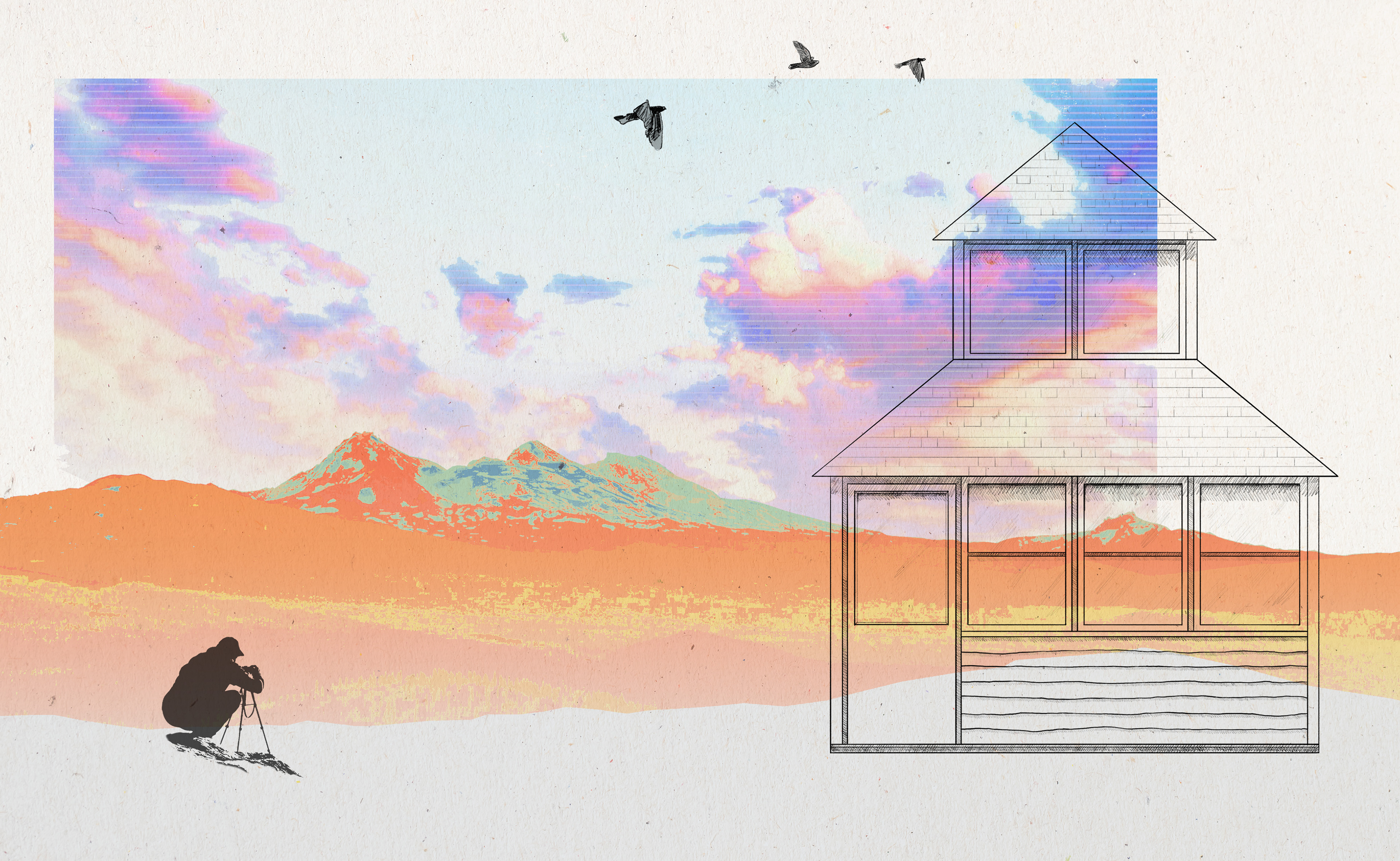
Modeled after the classic 1920's D-6 cupola, this lookout would be constructed minimally with wood framing and siding and would be entirely off-grid. There would be space on the ground floor for sleeping, a wood stove, and a desk. Within the cupola, accessed by a ladder, would be an Osborne fire finder, if needed.
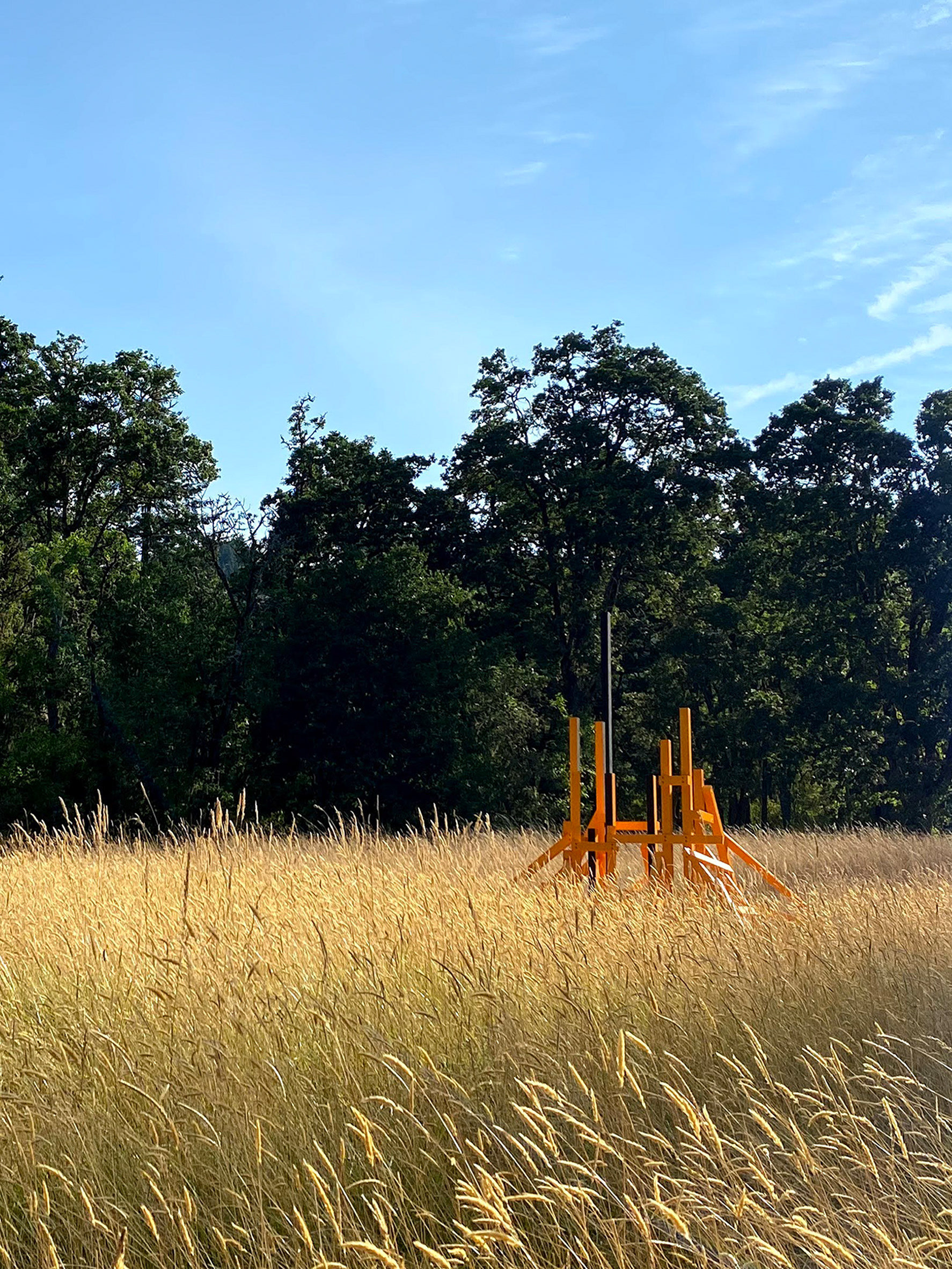
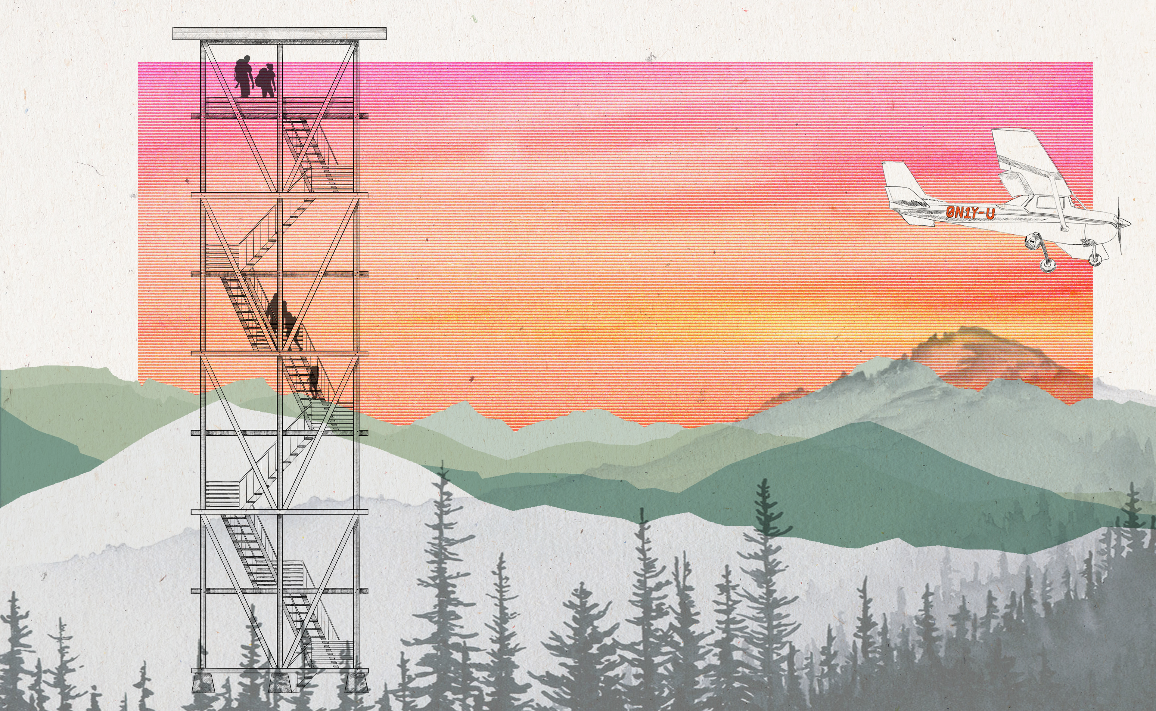
TOWER TRIO
A set of three towers sits to the north of the ranger station offers a very different experience and is themed after the fire triangle - spark, fuel, and oxygen. These towers would be available to rent, ideal for large groups like students.
They sit a few miles from one another along the ridge line boundary of the HJA. Carpenter Mountain, a staffed lookout, would also be visible to the north of the HJA. Because of their location within the border of the HJ Andrews, there would be opportunities for the programs to be developed alongside their research.
There is opportunity for each of these towers to be interactive and serve educational purposes in their structural design and in their programming. Speculative communication devices and other tools can be used to gain a more unique perspective. Literally looking through a new lens could offer an individual a new perspective of our landscape and its relationship with fire.
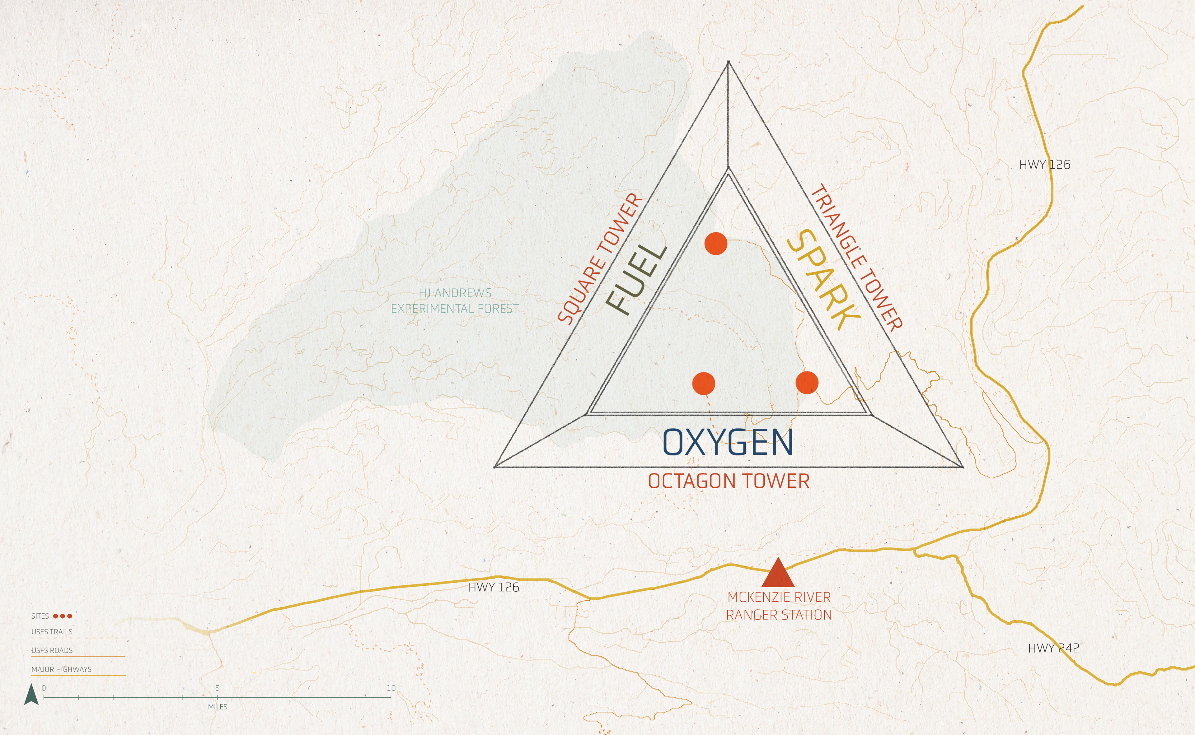
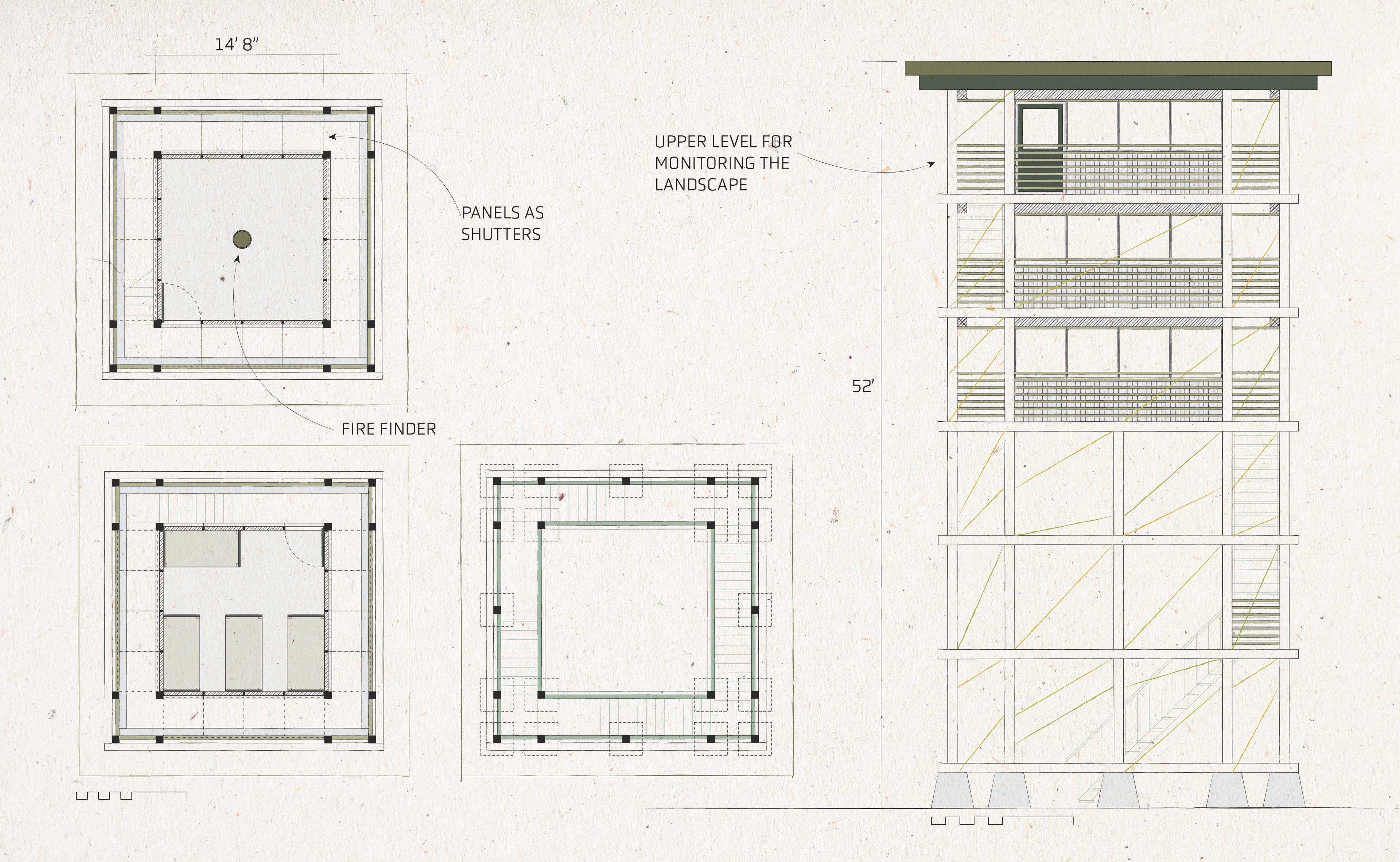
THE TRIANGLE TOWER
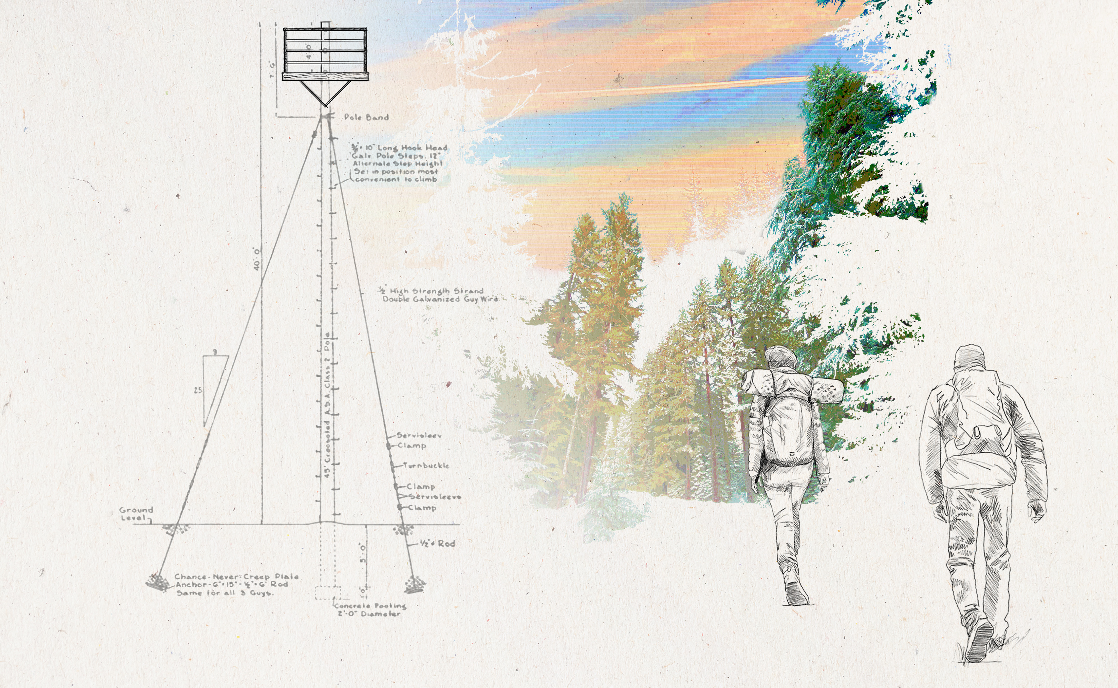
The first of the three is the triangle tower, which is themed around spark. Like many historic lookouts, this tower is paired with a ground cabin, meaning the tower itself is not intended as a live-in tower. It is also the tallest of the three, standing 84' feet tall. Its façad is detailed with triangles, in addition to being a triangle in plan. It would be equipped with an Osborne fire finder and other common lookout tools in the enclosed top floor.
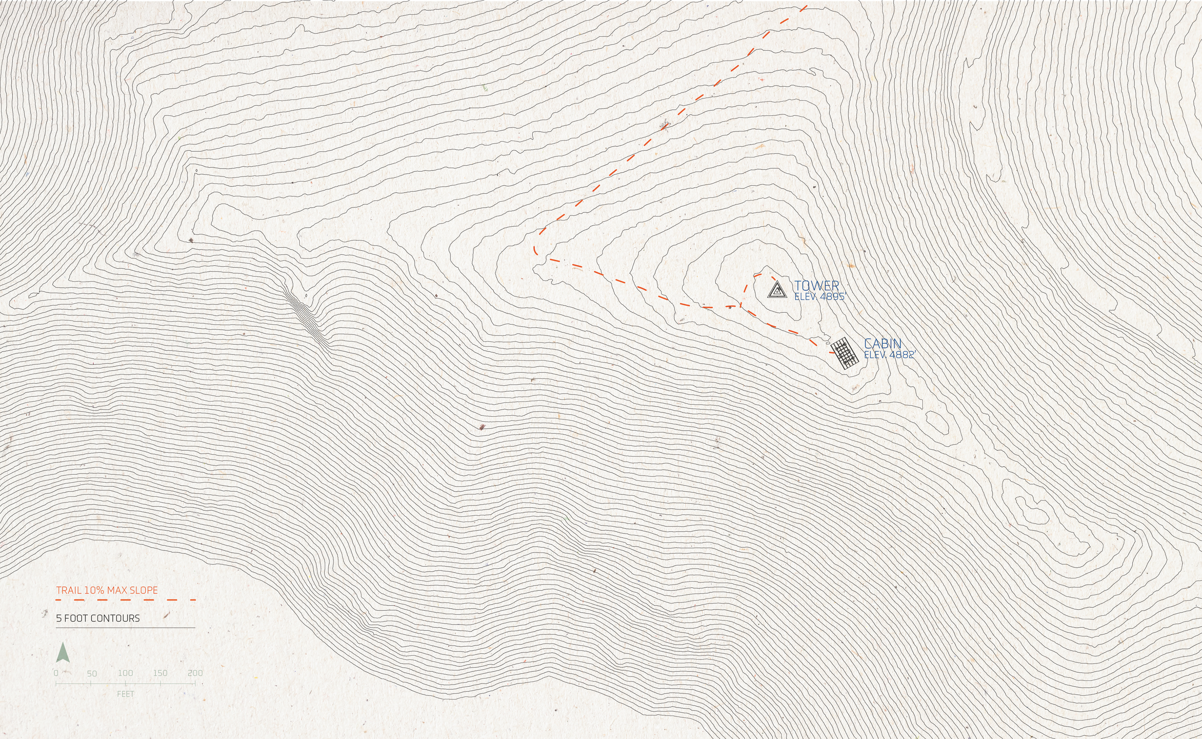
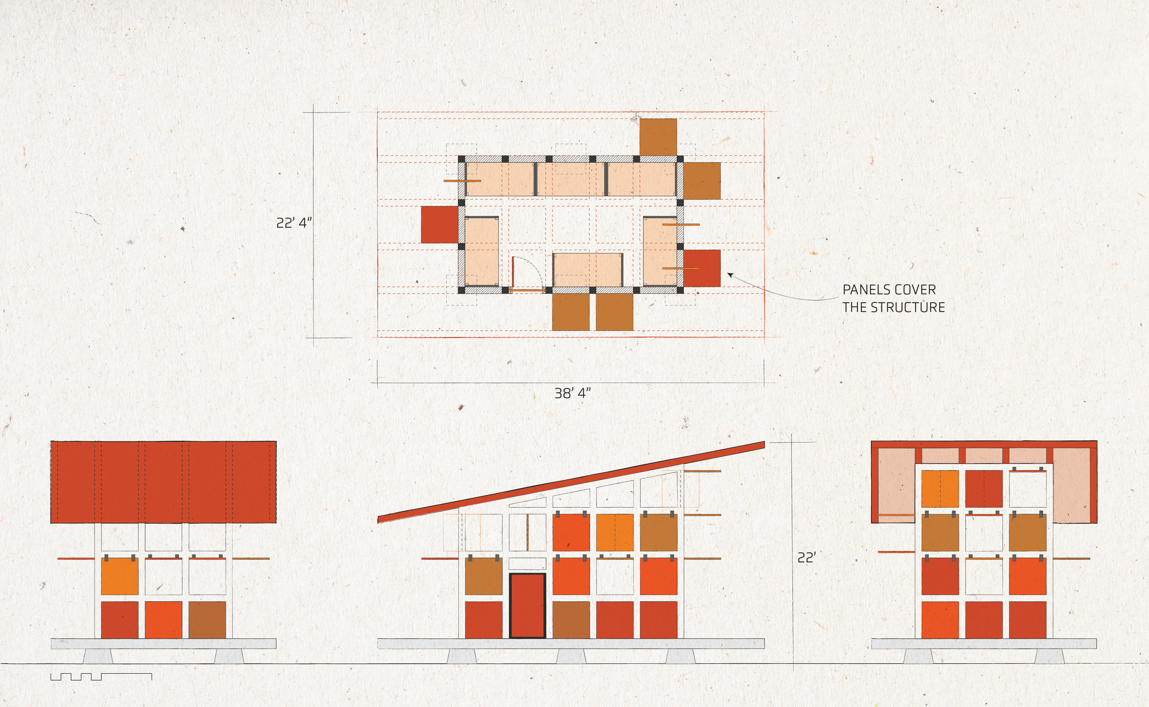
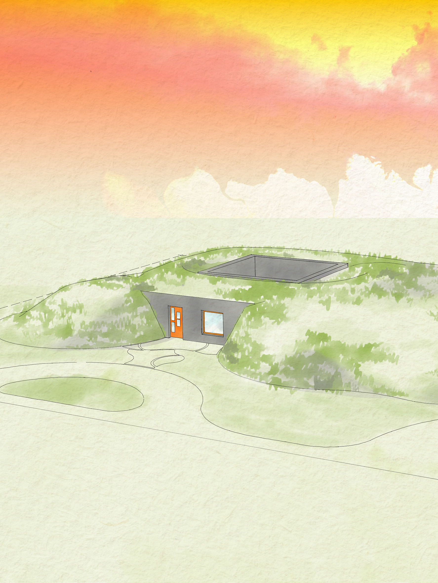
THE SQUARE TOWER
The square tower is themed around fuel. It sits within the HJA on what is known as Lookout Mountain, which previously housed the Lookout Mountain lookout. This tower is a twist on the R-6 flat roof cab: square and sleek with cable details. This tower stands just over 50 feet tall with two lower enclosed floors reserved for living quarters and the top floor equipped with lookout equipment. In this design, the shutters have been detailed to be designed panels.
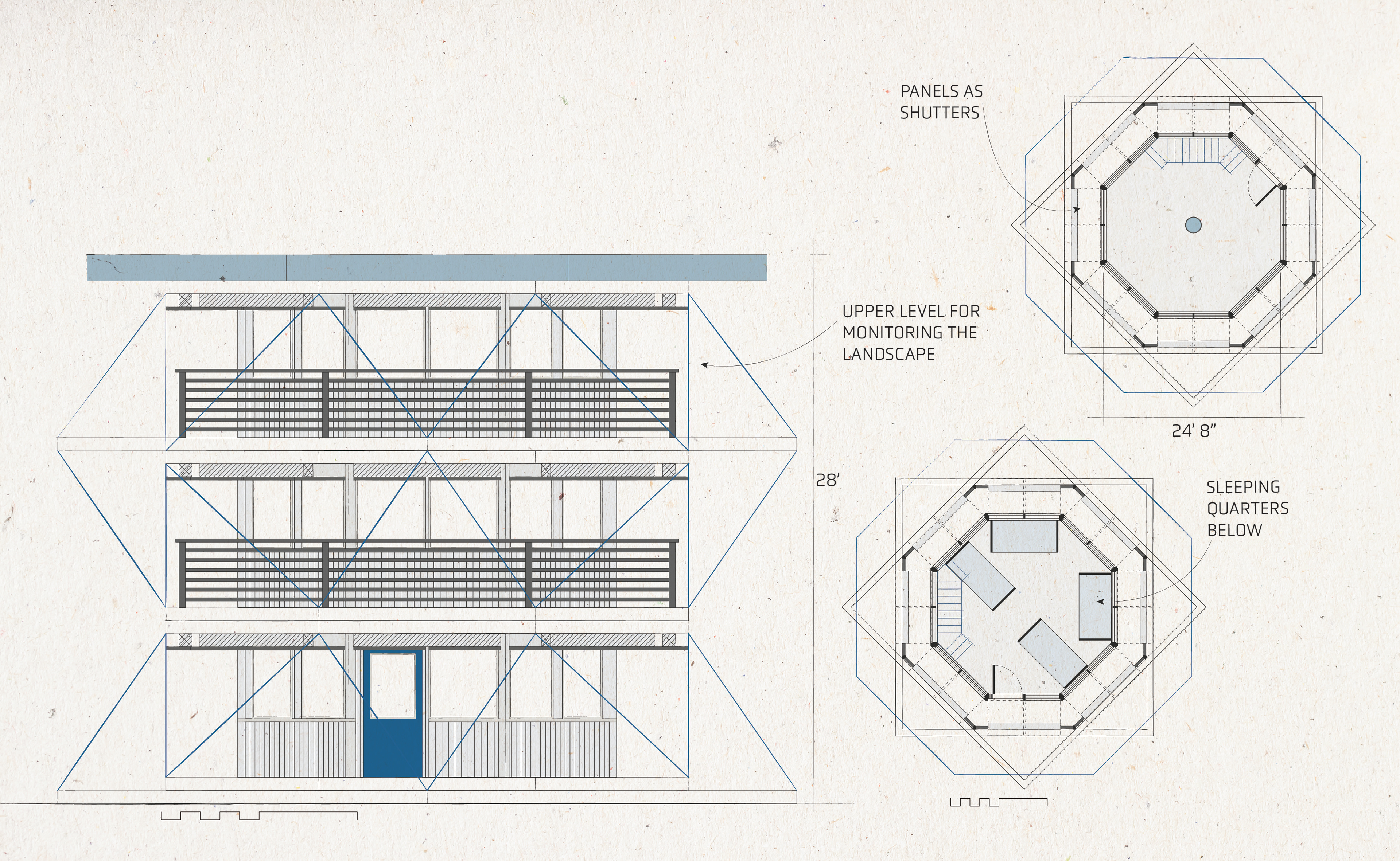
THE OCTAGON
This tower is themed around oxygen. It sits near Frissell Point on the southeastern corner of the HJA. This tower was inspired by octagon cabs and is detailed with cables. Like the square tower, the lower two floors are reserved for living quarters with the top floor for lookout use. In this design, the shutters have also been detailed to fit the designed panels.


GRAPHIC EXPLORATION
I was largely inspired by the artist, Matt McCormick. Programs used include Rhino, Adobe Fresco, Illustrator, and Photoshop.
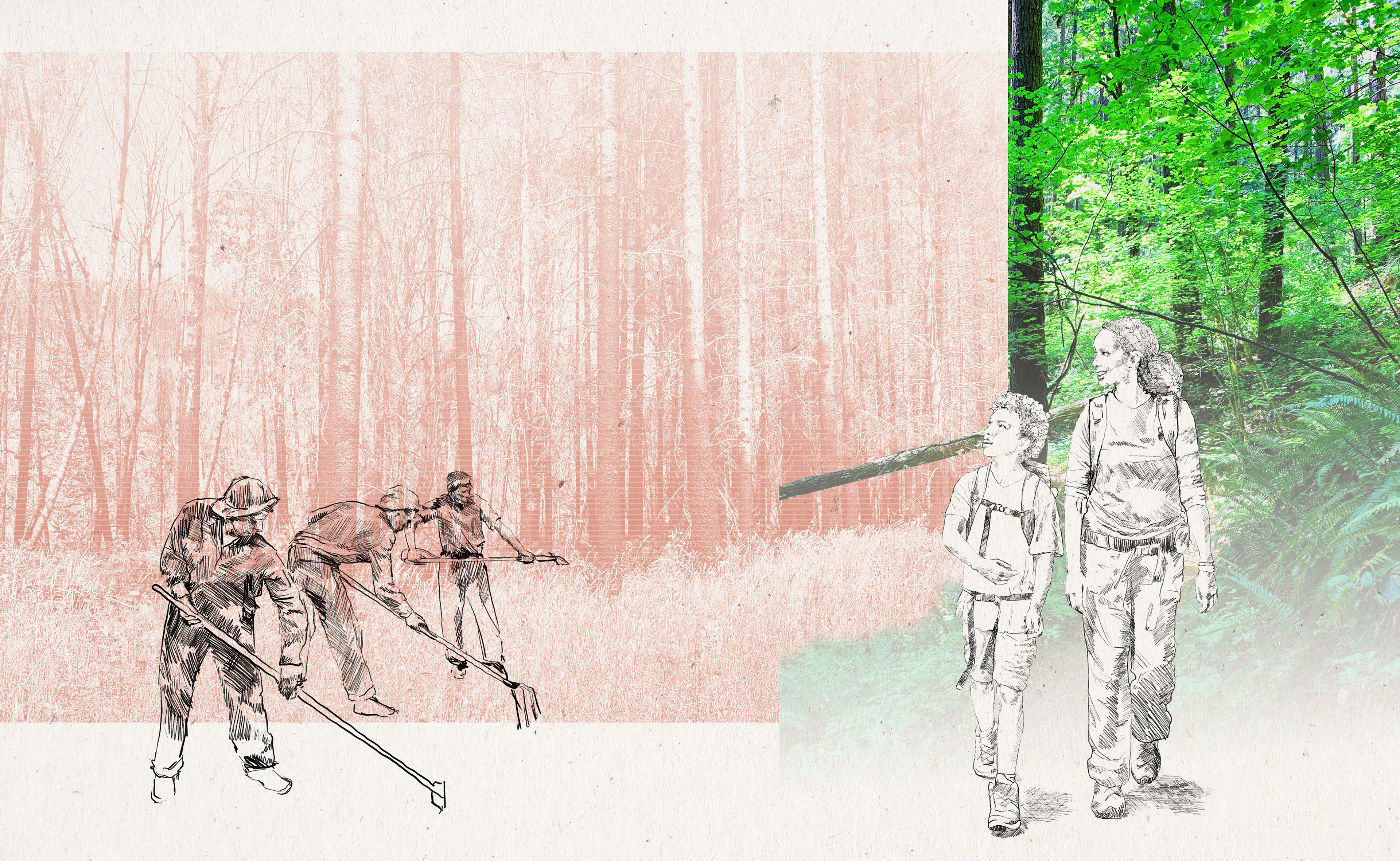
The primary goal was to integrate hand sketching with computer-based programs to develop a unique collage style that would be unique to landscape architecture. This style mimics scrapbooking to tell the story of fire - its past, present, and future.
My lightning stool design, made by DBB and crew, features one of my fire-crew sketches on electrified wood.

LOOKOUT REVIEW
With a decline in the use of lookouts across the nation, one might question the future of these structures and their role in managing fire on the landscape. It is important to address the significant role a lookout has in the response to wildfire. They are often more reliable than other monitoring technology like cameras and satellites. With climate change, conditions are more unstable, making fire management more difficult than ever. Lookouts are the first step in managing fires in our landscape.
A lookout is a structure - a strategically placed observation tower. Historically, a lookout was a camp or makeshift viewing platform. But, it can also be an individual - one who monitors the landscape for threats, usually weather. Most importantly, a lookout is a location. It is a high point on the landscape from which you can look out.
There is a lot of opportunity to expand on this project and I hope the inventory, typologies, and speculative designs can be inspiring for the next steps.